Please see the below weather update from the National Weather Service (NWS) New Orleans / Baton Rouge.
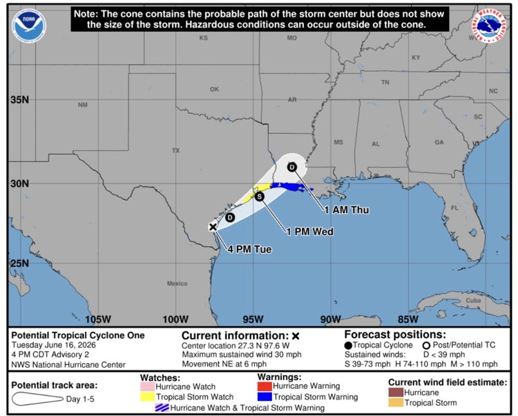
- Potential Tropical Cyclone One is forecast to become a tropical storm on Wednesday and make landfall Wednesday night near the TX/LA border.
- East Baton Rouge Parish is under the following watches/warnings:
- Flood Watch until June 19, 07:00 AM.
- Flood Warning in effect from June 17, 03:47 AM until June 18, 09:00 AM.
- Flood Advisory in effect from June 16, 05:18 PM until June 16, 07:15 PM.
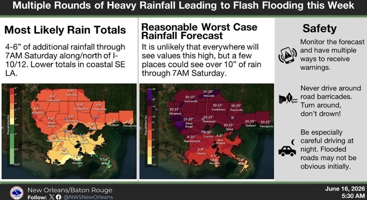
- The NWS is still forecasting 4-6” of rainfall for our area through Fridaywith most of the rain falling overnight Wednesday night.
- There will be a lull in the rainfall tonight and tomorrow morning. Scattered showers tomorrow morning and afternoon.
- Peak timing for EBRP is Wednesday overnight and into early morning hours Thursday.
- The NWS is forecasting sustained winds of 10-15 mph and gusts of up to 20-25 mph overnight Wednesday and into the early morning hours Thursday.
- Also, during this timeframe isolated tornadoes and severe weather are possible.